


CHINASE | ENGLISH
bottom
 DOWNLOAD
 E-MAIL

NEWS
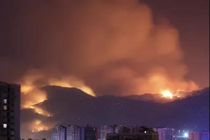
Resurgence! Crucial Extinguishment! FY Satellite Deployed to Urgently Support the Liangshan Fire Fighting in Sichuan
On March 30, 2020, a forest fire broke out in Xichang city, Liangshan Area, Sichuan Province. Due to the strong wind, the fire quickly spread and even endangered the urban area. Lots of heavy smoke went into the Xichang downtown area with the wind. At 6:00 am on the 31st of March, the fire on the west line of Xichang was put out. However, it came back again in the evening at Lushan Mountain. Early morning today, the localforest fire fighting and rescue forces were united and the crucial extinguishment was started in three ways towards the Lushan Mountain. FY Satellite, produced by Shanghai Academy of Spaceflight Technology, monitored the entire fire continuously and obtained the minute level image data of fire area, which provided precious decision-making support to the rescue.
According to the FY-4 satellite observation, the central longitude of the Muli fire site in Liangshan Area is 101.47°E and the dimension is 27.41°N. The visible fire area is about 84 hectares. The central longitude of the Xichang fire site 102.24°E and the dimension is 27.81°N. The visible fire area is about 34 hectares. The vegetation type under both sites is woodland. The smoke over the fire spots drifted towards east by north. By 22:00 pm (Beijing Time) on the 30th of March, The fire spot in the infrared cloud image of the FY-4 meteorological satellite was still maintained.
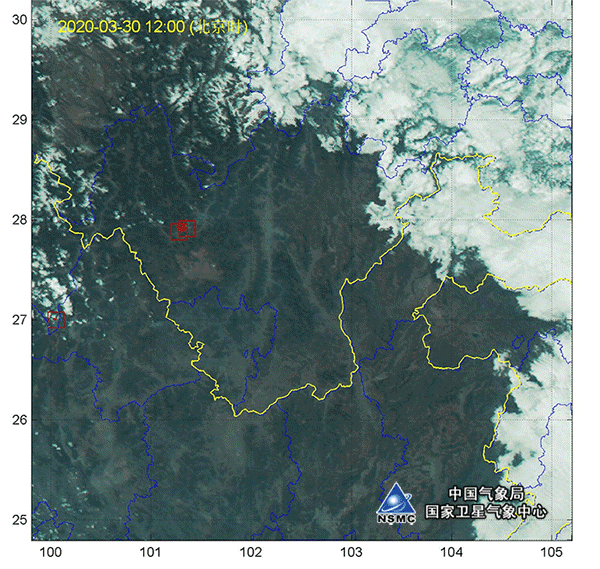
ΔThe dynamic status of both fire sites monitored by FY-4 A satellite from 12:00 to 17:00 pm on 30 March
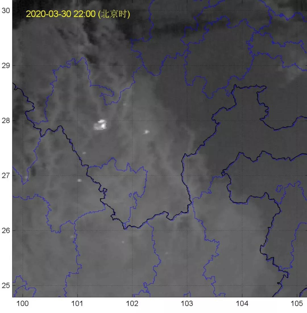
ΔFire Situation Monitoring Map of Muli and Xichang in Sichuan by FY-4 A MeteorologicalSatellite (22:00, 30 March 2020)
According to the continuous monitoring data from 30 March 16:00 pm to 31 March 9:00 am from FY-4 A satellite, the fire at Muli and Xichang fire sites were spreading to the northeast direction. Besides, fire at Mianning county, Yanyuan county etc. in Liangshan Area, Sichuan province were observed.
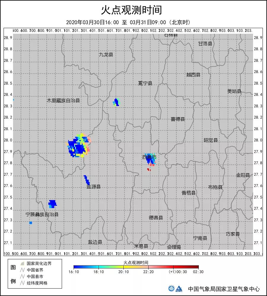
The Fire Duration Chart showed that the fire at the central part and northwest part of Sichuan Muli fire site lasted for more than six hours, while the fire at southeast corner, southwest corner and northeast corner lasted for more than 12 hours. And the fire in most part of Xichang fire site lasted for more than 12 hours.
The fire monitoring by meteorological satellite plays a very important role in forest fire prevention and grassland fire prevention. We started using meteorological satellite for forest fire monitoring purpose since 1986, which has contributed a lot to our forest fire prevention task. The meteorological satellite provides numerous reliable data for fire detecting and extinguishment so it is honored the name of “clairvoyance” of the Fire-fighting Headquarters.
For fire monitoring, FY-4 geostationary orbit meteorological satellite has the advantages of high temporal resolution and continuous monitoring, which can obtain minute-level image data of China and surrounding fire spots, as well as carry out 24-hour continuous fire monitoring. The FY-3 polar orbit meteorological satellite has the global observation capacity and can observe the global fire spot. It has observed many global forest fires in China and surrounding areas, California, Australia and so on.
Source: Photos and data are sourced from China Meteorological Administration, National Satellite Meteorological Center.