CHINASE | ENGLISH
bottom
NEWS
Breathtaking scenery appreciated above from Sky! International Horticultural Exhibition viewed from Space
This month, Wechat Moments are flooded by the news on China Beijing International Horticultural Exhibition 2019.
Eyes full of flowers, ingenuity everywhere.
So what kind of experience is it to see the Exhibition from space which is hundreds of kilometers high?

This is a 2m resolution satellite image.
A panoramic view of the whole park

This is the International Pavilion.

The Guirui Theatre is like a butterfly with wings fluttering.

The Botanical Garden opens its big eyes
which are full of green

Each part of Life Experience Hall is well-spaced

Yongning Pavilion is interdependent with mountains and rivers, extending in all directions
Implication: The country is prosperous and the people are at peace

Three Gorges are imbued with a spirit that conquers mountains and rivers

Potassium sulphate production base in Lop Nur
is like a gem embedded in desert.

The Hong Kong-Zhuhai-Macao Bridge spanning three cities

Beijing Daxing International Airport opens arms
to welcome guests and friends from across the world

And the FAST radio telescope
explores the mysteries of the universe

One after another artificial miracle on Chinese soil
is magnificent and dazzling
The main force for shooting these Chinese miracles
is the "Eye in the Sky" in space - Remote Sensing Satellite
developed by China Aerospace Science and Technology Corporation Ltd.
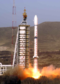
In 1975, China successfully launched and recovered
its first returnable remote sensing satellite.
For the first time, Chinese people look at their motherland with their own "Eye in the Sky"
Later, China launched
a series of returnable remote sensing satellites
Obtained a batch of precious remote sensing images
Serving national economic development
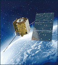
In 1999, CBERS-01 satellite successfully launched for the first time.
Clear images can be sent back to Earth in Space without returning to Earth

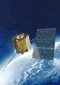
▲Schematic Diagram China-Brazil Earth Resources Satellite
In 2000, the first satellite of the CBERS-02 was successfully launched.
Subsequently, China launched a number of CBERS-01 and CBERS-02 satellites.
In 2012, CBERS-03 satellite also launched successfully.

▲ Schematic Diagram of CBERS-03
In 2013, the first satellite of China’s high-resolution Earth observation system,
GF-1, was successfully launched for the first time.

▲ Schematic Diagram of GF-1
Over the next few years
GF-2, GF-4, GF-3
Satellite 02/03/04 of GF-1, GF-5 and GF-6
And a series of satellites successively flew into space
The construction of high-resolution earth observation system in China
is proceeding at full speed

▲ Schematic Diagram of GF-5

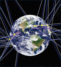
▲ Schematic Diagram of GF-5 and GF-6 satellites network operation
In addition to "CBERS" and "GF", "Eye in the Sky" of China's space also has commercial remote-sensing satellites "SuperView" series, "FY" series serve in the field of meteorology, and "HY" series serve in the field of Marine.
China's "Eye in the Sky" has more and more skills
the division of labor is more and more professional
the coverage is wider and wider
the working hours are getting longer and longer
and seeing things more and more clearly
Providing high-quality services for
agriculture, forestry, animal husbandry, water conservancy, land and resources, urban planning, environmental protection, disaster monitoring and ecological construction
in China and other countries and regions,
and witnessing the new miracle that China has constantly created.
Source: CCTV News official WeChat, Chinese Academy of Sciences official WeChat, "China Aerospace News"
![]()
![]()
![]()
![]()
![]()
![]()
![]()





 DOWNLOAD
 E-MAIL