


CHINASE | ENGLISH
bottom
 DOWNLOAD
 E-MAIL

NEWS
Remeasure the top of the world! Mountain Qomolangma is more beautiful at this viewpoint
At 02:10 A.M., May 27
8 members of the 2020 Mountain Qomolangma Height Measuring Survey Team(As well as camera crews) departed the climbing base camp at the altitude of 8,300 meters, and started to challenge the summit!
At 11:00, May 27, they reached the summit! Measured the height! Succeeded!
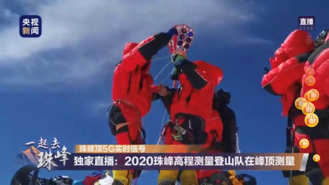
(5G realtime signal from the summit Mountain Qomolangma
Exclusive: members of 2020 Mountain Qomolangma Height Measuring Survey Team are measuring at the summit of Mountain Qomolangma)
Members erected the survey marker at the summit of Mountain Qomolangma
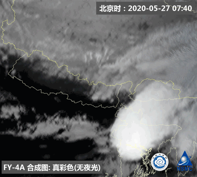
(Beijing Time: 07:40 May 27, 2020
FY-4A composite diagram: true color (non-luminous))
FY-4A geostationary meteorological satellite monitoring gif (From 07:35 to 11:15 May 27, 2020)
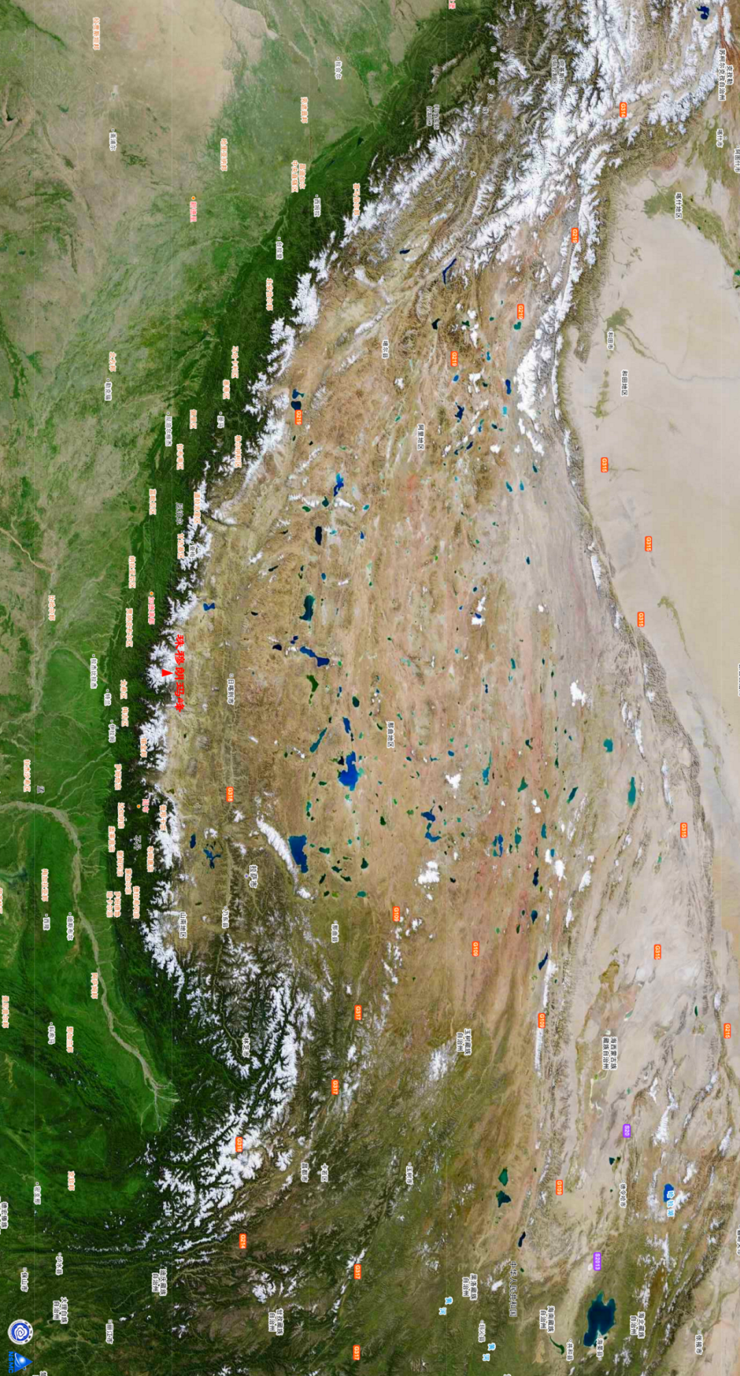
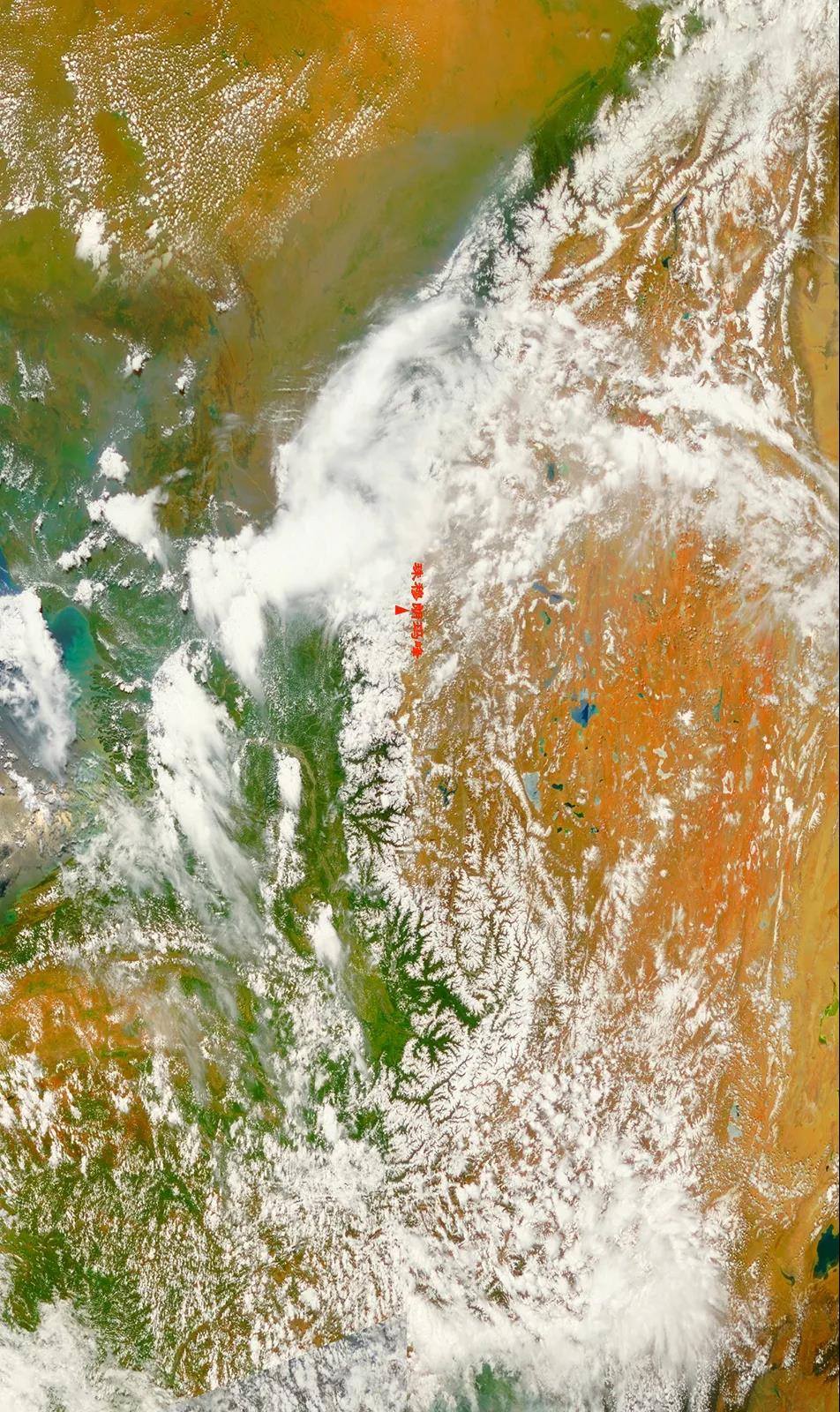
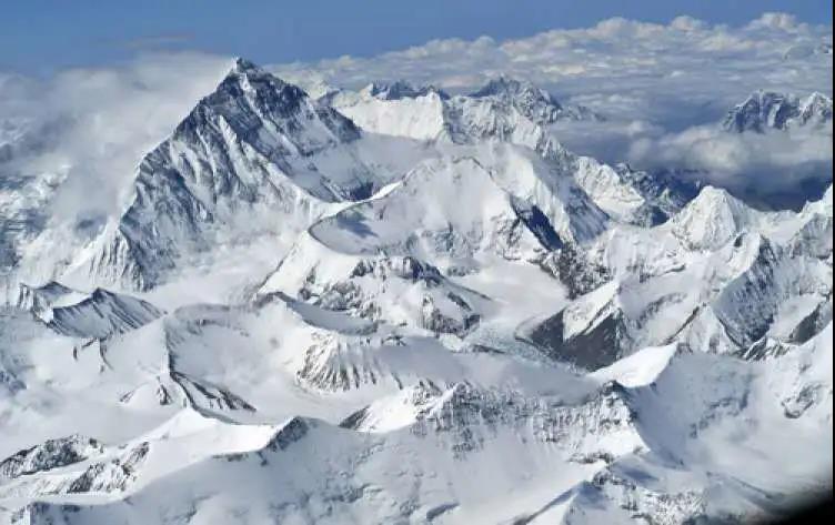
Mountain Qomolangma, the world’s highest peak, is located in Qinghai-Tibet Plateau
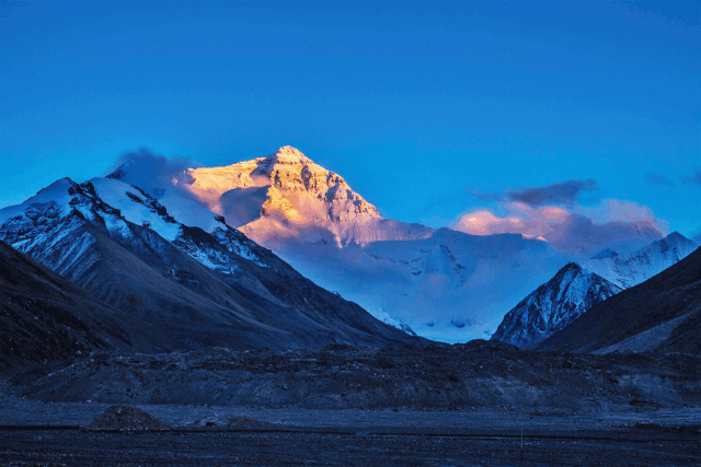
Golden summit of Mountain Qomolangma.Please view in horizontal screen↓↓↓
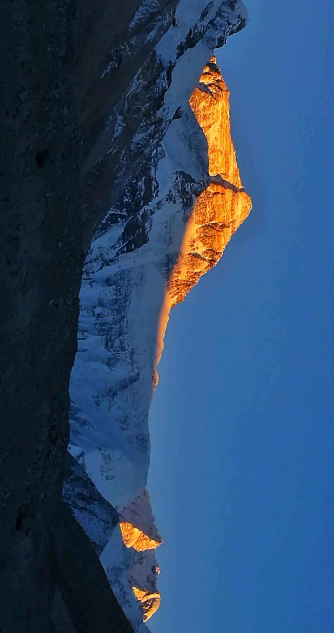
Photo by Zhao Haibing
This year marks the 60th anniversary of the first successful expedition to Mount Qomolangma,
and the 45th anniversary of China's first accurate measurement of Qomolangma's height.
On April 30
The project Mountain Qomolangma Height Measuring 2020 was officially launched at the base camp
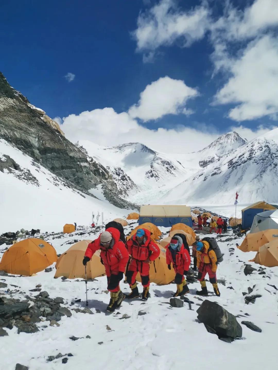
The 2020 Mountain Qomolangma Height Measuring Survey Team. Photo by Tashi Tsering
Meteorological departments fully protected thiscampaign to measure the height of Mount Qomolangma, and provided key supports
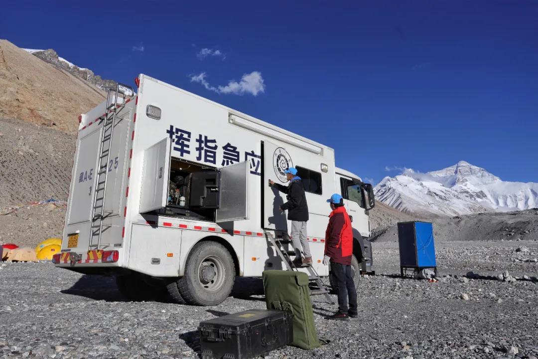
Weather emergency vehicle entered the base camp at Mount Qomolangma. Photo by Laussane
Mount Qomolangma has a complex and ever-changing climate, in some places, the snow stays all year round, ice sheets, ice slopes and serac bands can be found everywhere
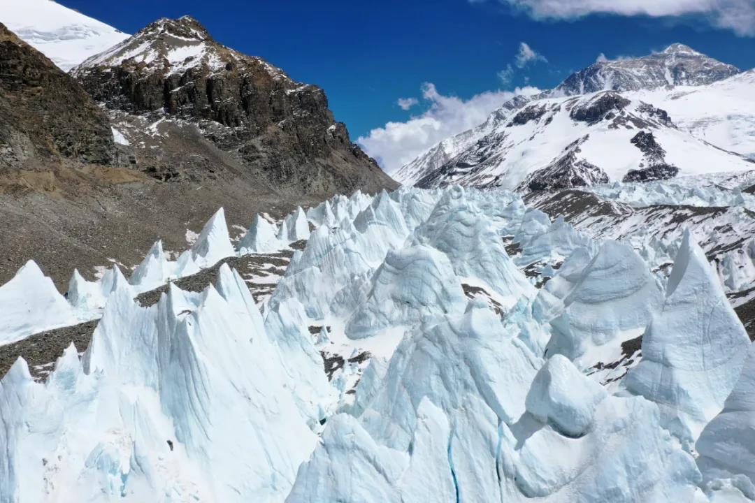
Serac bands at Mount Qomolangma, Photo by Laussane
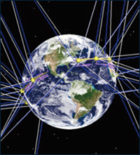
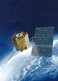
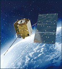
Today, FY meteorological satelliteswill bring us up to the high altitude of millions meters to overlook Mount Qomolangma, and appreciate magnificent sight of the“top of the world”
Let’s summit Mount Qomolangma together with the warriors
Lock on Mount Qomolangma
Qinghai-Tibet Plateau shot by FY-3D satellite.Please view in horizontal screen↓↓↓
Credit: the National Satellite Meteorological Center
Mountain Qomolangma is the main peak of the Himalayas that lies on the border between China and Nepal
North of the mountain is located in Tingri County in Tibet, China
It is the center of Mountain Qomolangma Nature Reserve which spanning across 4 counties in China and Nepal National Park
View from FY-3D satellite, Mountain Qomolangma is surrounded by pervading cloud and mist, and covered by thick snows. Please view in horizontal screen↓↓↓
(Mountain Qomolangma)
Credit: the National Satellite Meteorological Center
The lowest temperature at the summit of Mountain Qomolangma maintains at minus 30~40 ℃ throughout the year, and the summit is covered by snow all year around
Mountain Qomolangma is windy, where gale of force 12 is not rare, every June to September, Mountain Qomolangma will enter in rainy season, during this period
There are frequent rains, the weather is ever-changing, and there is always cloud and mist pervading in the air
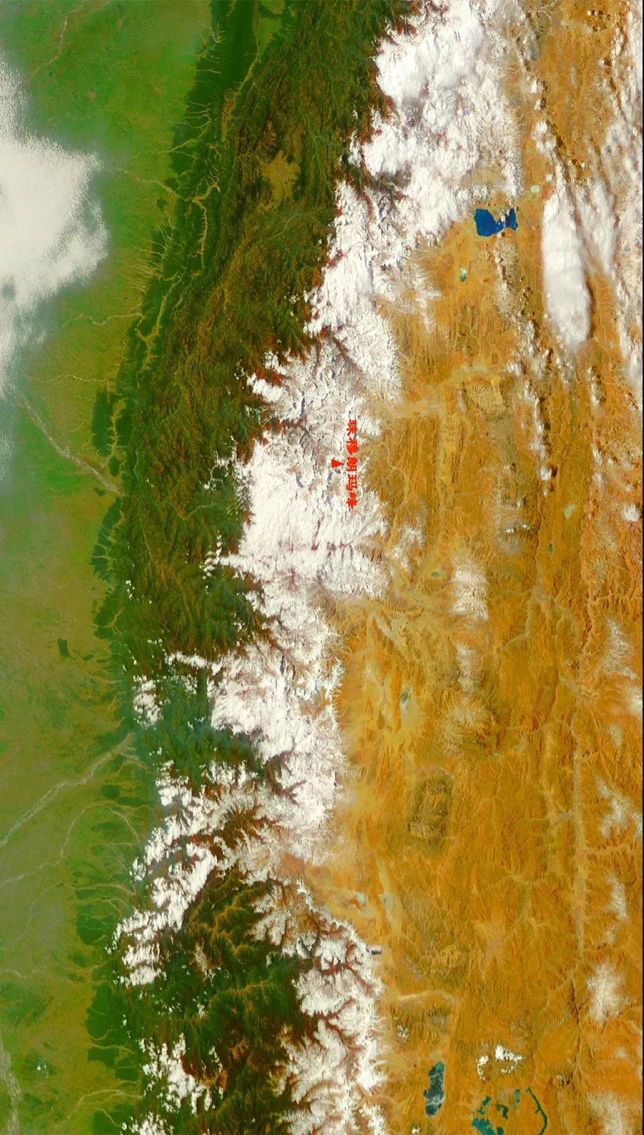
Mountain Qomolangma and the base camp shot by FY-3D satellite.Please view in horizontal screen↓↓↓
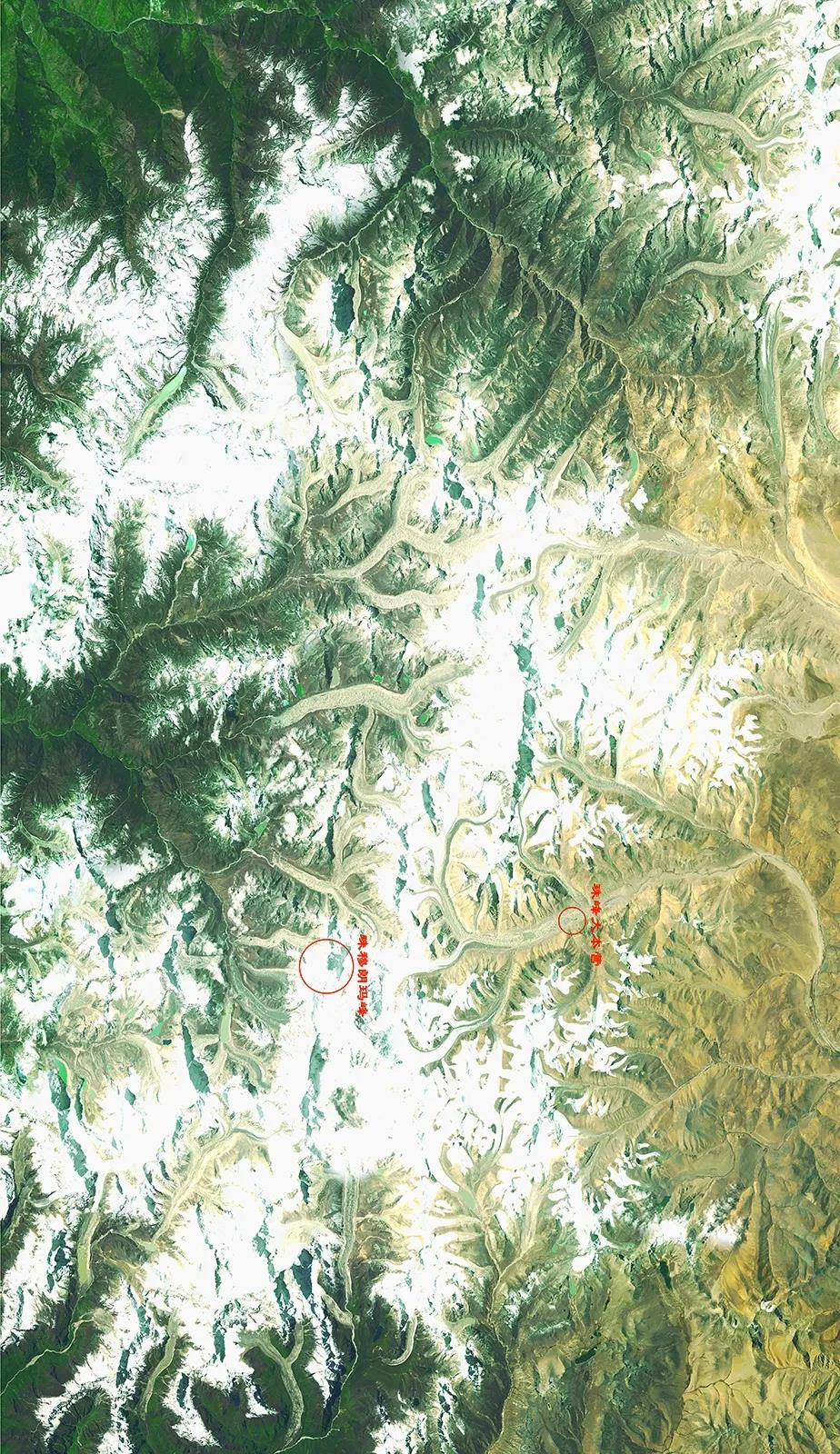
(Mountain Qomolangma, the base camp)
Credit: the National Satellite Meteorological Center
This time, the Mountain Qomolangma Height Measuring Survey Team started from the base camp at Mountain Qomolangma, passed through the advanced base camp,
North Depression, the attack camp, etcand climbed along till the summit
Overlook from millions meters high altitude, the short distance of less than two fingers space, however, only warriors cango beyond
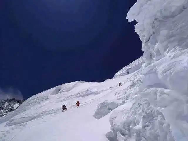
There is risk of snow flow at the ice wall of North Depression. Chinese Mountaineering Association, photo by Bazándamchoe
Four seasons at Mountain Qomolangma
Climate at Mountain Qomolangma
It may be divided into dry season and wet season, the dry season is controlled by upper westerlies, and the rainy season is under the influence of the southwest monsoon from the Indian Ocean
According to the climate features at Qinghai-Tibet Plateau, researchers usually defined the four seasons of Mountain Qomolangma as below:
Spring is March and April, Summer is from May to August
Autumn is September and October
And winter is from November to February of the next year
NO.1 Spring
April 10, 2020 (Spring), Mountain Qomolangma shot by FY-3D satellite. Please view in horizontal screen↓↓↓
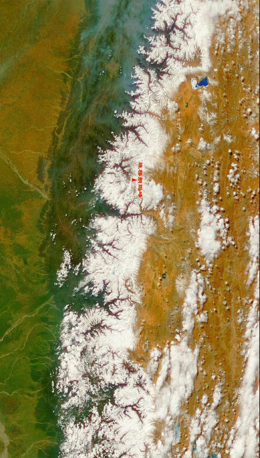
(Mountain Qomolangma)
Credit: the National Satellite Meteorological Center
Every spring and autumn, the weather is more preferable, and they are the best seasons for climbing Mountain Qomolangma
Due to the change of atmospheric environment, in April and May every year, the wind power at Mountain Qomolangma will abate significantly, and the temperature difference between day and night is also reduced, it is often considered as the “golden season to summit”
NO.2 Summer
August 20, 2019 (Summer), Mountain Qomolangma shot by FY-3D satellite. Please view in horizontal screen↓↓↓
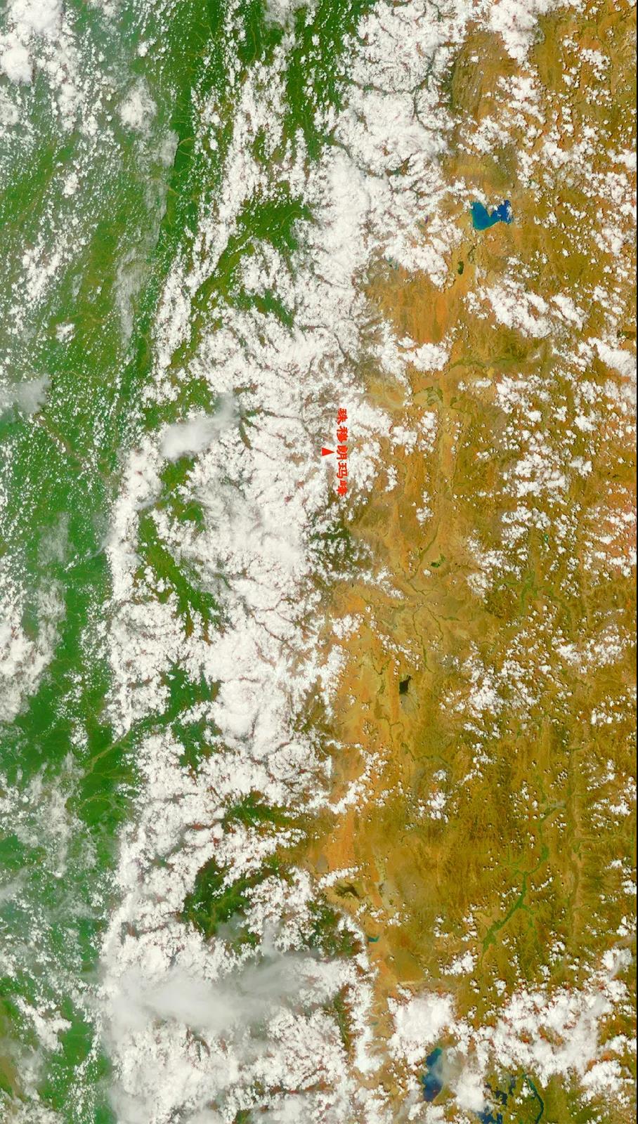
(Mountain Qomolangma)
Credit: the National Satellite Meteorological Center
Summer comes, Mountain Qomolangma also enters the rainy season, at this time
There is a lot of rain, cloud and mist is pervading in the air, this may be observed even from the satellite millions meters high above
NO.3 Autumn
October 12, 2019 (Autumn), Mountain Qomolangma shot by FY-3D satellite. Please view in horizontal screen↓↓↓
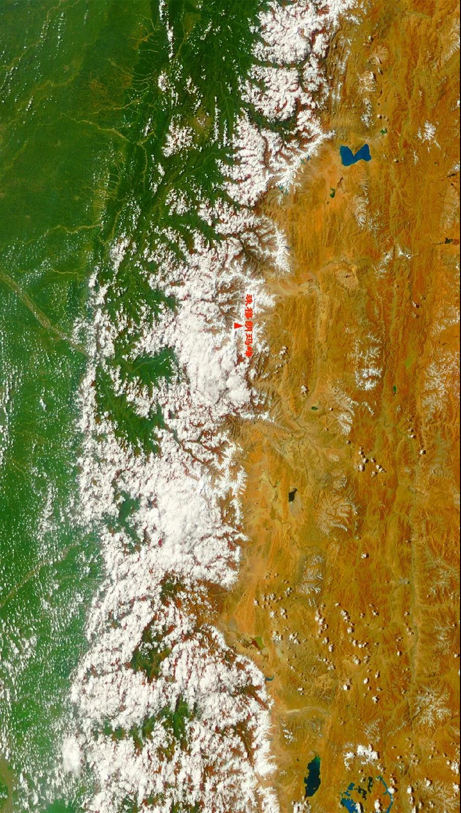
(Mountain Qomolangma)
Credit: the National Satellite Meteorological Center
When it is Autumn, monsoon starts relaxingthe control of Mountain Qomolangma, and westerlies reigns, during this period, there may still be preferable weathers time to time
Farmers and herdsmen at the foot of Mountain Qomolangma also head into the harvest season
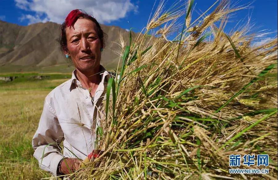
In September, farmer from Lazi County, Shigatse City, Tibet harvests highland barley. Xinhuanews
NO.4 Winter
While in winter, under strong northwest stream, the lowest temperature at Mountain Qomolangma can decrease to -50℃
The highest wind speed may reach 90 m/s
If climbing in this season, the climber can be easily blow away from the mountain or the ice and snow can be blown down from the top, which will bring big trouble toclimbers
January 14, 2020 (Winter), Mountain Qomolangma shot by FY-3D satellite. Please view in horizontal screen↓↓↓
(Mountain Qomolangma)
Credit: the National Satellite Meteorological Center
Mountain Qomolangma in the land of snow
Mountain Qomolangma, the world of snow. Photo by Jueguo
The body of Mountain Qomolangma
Presents in the shape of a huge pyramid, it has anextremely dangerous terrain, with serac bands, ice cliffs, crevasses, ice-fall and avalanche zones everywhere
However, in the eyes of explorers, the danger covered by ice and snow is also the embodiment of Mountain Qomolangma’s Fatal Attraction
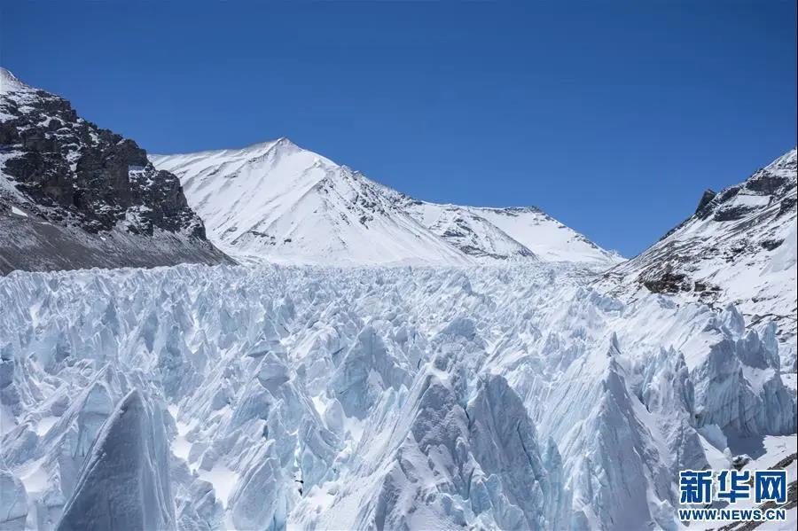
On May 9, the serac bands at 5,800 meters to 6,500 meters of Mountain Qomolangma Photo by Sunfei
In recent years, under the background of global warming, the warm-wet degree of Qinghai-Tibet Plateau is also exacerbating
While change of the snow cover at Mountain Qomolangma
has also become
One of the response indicators of global climate changing
Over the same period from 2017 to 2019, true color photo of snow at Mountain Qomolangma shot by FY-3D satellite
↓↓↓
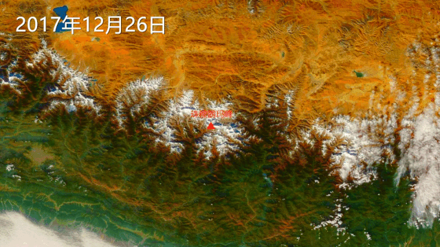
(December 26, 2017)
Credit: the National Satellite Meteorological Center
Does it provide an intuitive sense that there is more snow in 2019?
And it actually does. Since 2001
The National Satellite Meteorological Center
Has been continually monitoring the
Change of snow cover at Mountain Qomolangma
analysis data is as below
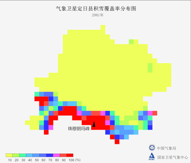
(Snow coverage distribution map of Tingri County monitored by meteorological satellites
2001
Mountain Qomolangma
China Meteorological Administration
the National Satellite Meteorological Center)
From 2001 to 2009, snow coverage distribution map of Tingri County monitored by meteorological satellites. Credit: the National Satellite Meteorological Center
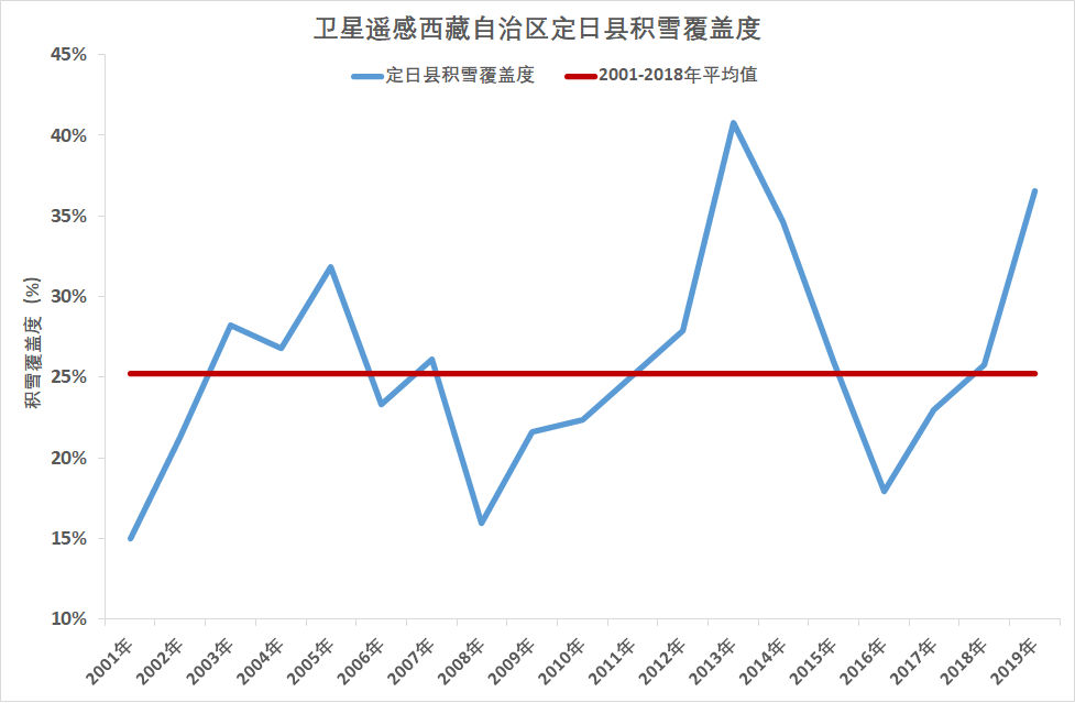
(Snow coverage line chart of Tingri County of Tibet Autonomous Region monitored by remote sensing
Snow coverage of Tingri County Average value of 2001-2018
Snow coverage (%))
From 2001 to 2009, snow coverage line chart of Tingri County monitored by remote sensing. Credit: the National Satellite Meteorological Center
In recent 20 years, under satellite remote sensing monitoring, the annual trend of snow coverage in Tingri County where Mountain Qomolangma is located,
Is not obvious yet
However, in recent years, the snow cover has shown change characteristics of fluctuation
(For example, the snow coverage of 2019 actually exceeds that of the years before)
Which trend it implies, it still needs in-depth research by experts and scholars of the related fields
For a long term, meteorological departments have provided precious satellite remote sensing data to
Protect life and safety of the people in plateau, strengthen the national ecological security barrier and
Research on global climate change
Protect the ecological climate and environment of Mountain Qomolangma, guardthe Third Pole of the earth
We are in action
Source: China Meteorological FY Satellite Wechat public account